Cross Your Fingers: Sag Harbor Will Likely Get Its Waterfront Park

Back in July, the local people of Sag Harbor held a fundraiser out on Long Wharf hoping to stop developers from putting a gated condominium community onto waterfront property the developers owned behind the 7-Eleven. The money raised would be given to the Village to give to the developers. They raised the astonishing sum of $131,025. This is for 2.33 acres of waterfront in the center of downtown. They’d hold 50 such fundraisers if necessary, some said. That’s how much the townspeople wanted to stop this project.
The Village government is in touch with the townspeople. They let the developers know that there would be other hurdles to overcome to make a 2.33 acre gated community there. Indeed, the Village government has discussed plans to seize this property by eminent domain, valued at whatever an appraiser declared it to be worth. It might take years.
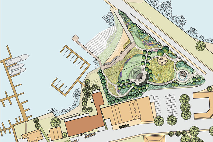
The property, in roughly a triangle shape, is bordered on the east side by the Lance Corporal Jordan Haerter Veterans Memorial Bridge, which already has a small public beachfront park—an apron of beach and grass about 20 feet wide and 150 feet long, running along the east side of the bridge ramp. The 2.33-acre parcel is currently occupied by four abandoned buildings, lots of foliage, brambles, stickers, briars and a beat-up abandoned road. Tear all that out. Make it a park, open it up, and there you will have a beach facing out to the inner harbor, where, late in the day, the sun sets. You could spend a morning sitting on a park bench by the beach on the east side of the bridge. You could stroll under the bridge and sunbathe on the west side on the arc of the beach in a more secluded spot. Meanwhile, as viewed from Long Wharf, this new park, now on both sides of the bridge ramp, would spread out in a panoramic waterfront view that would be a sensational new amenity for visitors downtown.
The village trustees have been huddling with representatives from Greystone Property Development Corp. for a number of months, and two weeks ago, the developers and the village announced they believed they had found a way to make a win-win situation out of this. The new plan was presented by architect Gary Brewer, a partner at Robert A.M. Stern Architects, at a rare assemblage of four village boards and committees—Planning, Zoning, Harbor and Historic Preservation—at Village Hall.
I think most people looked at this meeting skeptically. Perhaps the proposal would be to divide up the land. We’d get a small park. They’d get a building on a smaller lot. It might fly. It might not.
Instead, the developers proposed something completely unique and absolutely sensational, in my view. The Village would get the whole park. The developers would get their proposed building waterfront but it would not impinge on the park. In fact, ALMOST ALL OF IT WOULD NOT EVEN overlook the park. An understanding of the site model they brought to this meeting shows how this magic was done.
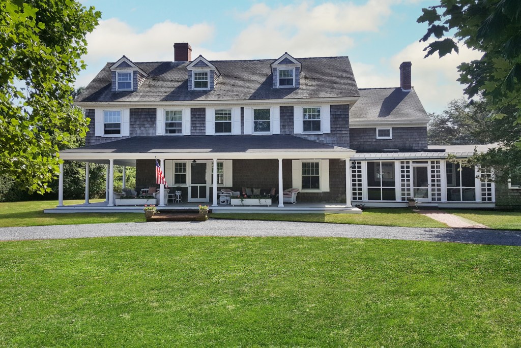
One of the four roads that branch off from the base of Long Wharf is West Water Street. Go down it a hundred yards or so and on your left is the post office, and across from it and a little further down, between the Beacon Restaurant and the old Library Annex, is an abandoned three-story building originally constructed as a waterfront 15-unit motel. Built around 1985, it failed as a motel after 10 years, then was remodeled and made into a 1-800-LAWYERS building. It’s a pretty building with a clock tower cupola on the top. But it’s been for sale with no buyers for many years. Nobody knows what to do with it.
The developers of 2 West Water Street, which is what they call their plan at the arc of the beach here, do know what to do with it. They propose to tear 1-800-LAWYERS down. In its place they’ll build a new three-story main building roughly the same height and length as the old building, but a bit thicker. The project would also include a smaller two-story building, and the entire complex would have 13 luxury condominium units. The front, if approved, would face out to West Water Street. The back of it would face a lawn, a small beach and the harbor. Each unit would have a porch to overlook the water. There’d be an underground garage for 14 cars below. And a new dock for the condominium owners’ boats. In other words, their main new building would simply replace a building already there.
And what else?
That’s IT!
All the rest of the property would be deeded to the Village for the entire hoped-for park of gardens, walkways and that wonderful arc of beach that’s always been there hidden away. There would be access to it not only by walking under the bridge but also from West Water Street itself. It would be a magnificent new John Steinbeck Memorial Park.
It’s a long way from the cup to the lip, though. I hope that it makes it through. And I hope that instead of giving these developers a tough time—discussion of low-income housing donations, height requirements, inviting access to their little beach, etc. etc.—they give the developers a medal. This will make a breathtaking finale to all of downtown Sag Harbor.
* * *
The history of this particular parcel is rather remarkable. During the last 50 years, when Sag Harbor blossomed into a wonderful 21st century former whaling village, with high regard for history, yachting, architecture and tourism, this piece of property was a sort of no man’s land of flies and sticker bushes and woods. It was known there were different parcels in there with different owners who couldn’t agree on how to get their act together. This complicated situation seemed as if it might go on forever.
But then, about 10 years ago, landscape architect Ed Hollander took a walk down the small park on the east side of the bridge, he told me, and when he reached the spot where the bridge leaped up and over the water from the Sag Harbor side toward North Haven, he realized that if you wanted to, you could turn left and walk under the bridge and see what was there from the water side. He did that.
He found, and others after him found in that tangled landscape an overgrown road, an abandoned ferry building, a broken-down wooden dock and the arc of a lovely beach looking out at the sunset. The overgrown road turned out to have been the end of Route 114, separate from the present 114 that continues now over the bridge, ending at where a ferryboat would take passengers and freight across the inlet from Sag Harbor to North Haven. This was before they built the bridge.
About the same time, the owners of the various parcels figured out how to create a development plan on these 2.33 acres to make it a gated condominium complex. When the plans were presented to the Village authorities a few years ago for their approval, in print and on the internet, all hell broke loose. Hollander was asked by the Village to design a park on the site—with an access by walking along the beach on the other side and under the bridge—and he did that. And that is how we have gotten from then until now.
This is a big moment in Sag Harbor’s history.


