Southampton Most at Risk By Land Value from Rising Sea Levels

Southampton, we have a problem. Yes, we’ve long known about sea level rise, but new data compiled by a group called the Union of Concerned Scientists shows that in the US, Southampton has the second highest level of property tax revenue at risk. (Congratulations, Central Coast, California! You’re the big loser here, with Southampton close behind.)
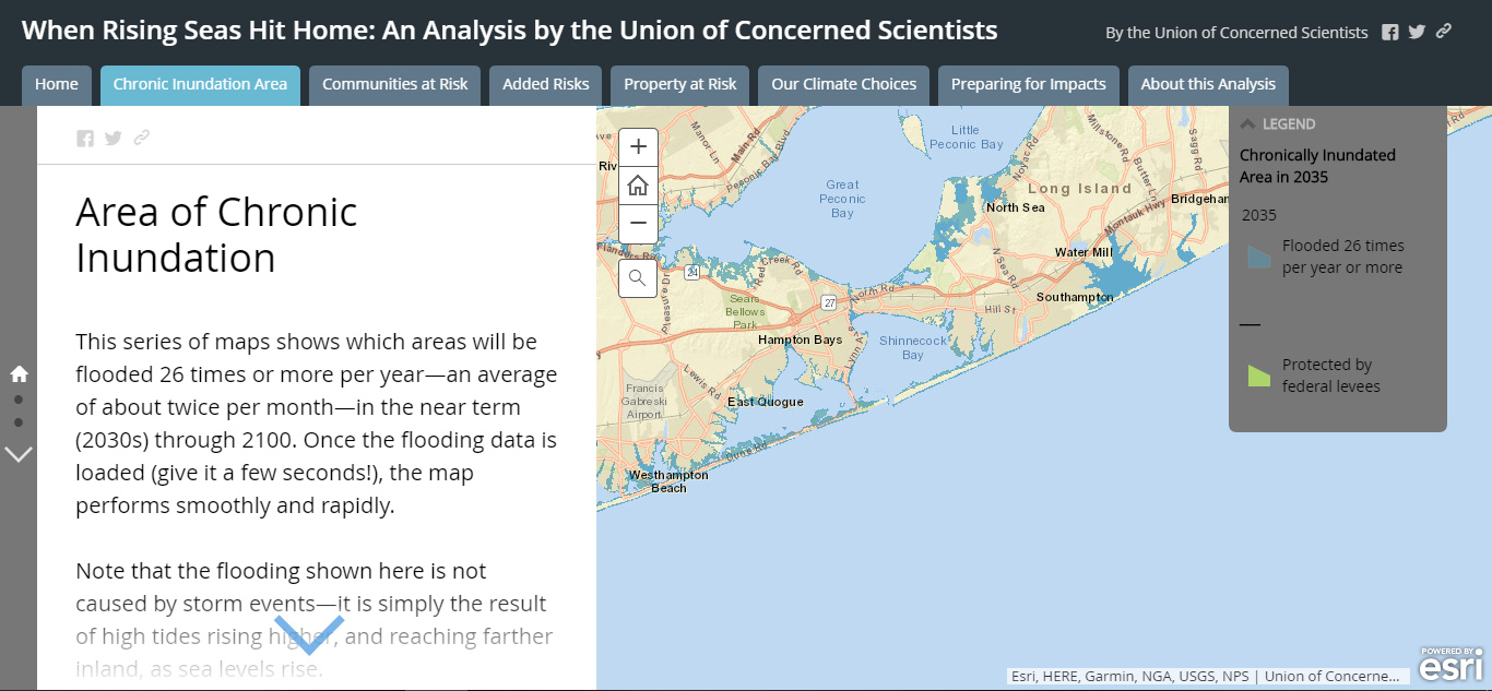
In fact, Southampton may well be the most vulnerable in the nation based on home values. The Union of Concerned Scientists used Zillow estimates to calculate values, and any casual user of Zillow in the Hamptons knows the values tend to be laughably underestimated when it comes to waterfront property. (The other data used in the analysis was published last year by the scientists, detailing areas of “chronic inundation,” which means in this case 26 times a year.)
Climate change will drive sea level rise. That means that coastal communities such as Southampton are in big trouble. East Hampton is less at risk, as a good bit of the coastline–think Montauk bluffs, for example–is above sea level. Westhampton Beach, Meadow Lane–areas built on barrier islands or as-good-as barrier islands are at serious risk, with the possibility of being flooded 26 times per year by 2030. (Which is only 12 years away, folks…)
The Union of Concerned Scientists points out that the data reflects sea level rise, not storms. And of course, property values will sour, infrastructure will erode and local taxes will slump. This means that municipalities’ credit ratings will dip and make it harder to finance projects to ameliorate the problem.

What can we do? On a local level, we can do things like elevate structures; use fewer impermeable materials on the ground so that water can drain instead of flood; plant bio-retention gardens and bioswales. But the real change has to come at the state and federal level: cut carbon emissions, improve flood insurance, and other initiatives. Let’s get started to save our beautiful community.


